
Le Petit Tour des Aiguilles Rouges: an autumn hike in photos
- Veronica

- Nov 10, 2025
- 3 min read
Overview
Date: 13-16 September, 2025
Location: Chamonix, France
Total distance: 47.39 kilometres (29.4 miles)
Elevation gain: 3,019 metres (9,905 feet)
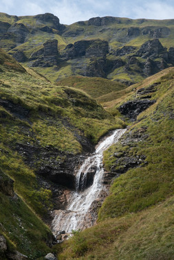
Highlights: Communal dinner at Refuge de la Pierre à Bérard, lots of waterfalls, seeing the Milky Way, impressive views over the massif du Mont-Blanc

Tour summary:
This multi-day hike is a slightly shorter version of the traditional Tour des Aguilles Rouge (and in the opposite direction), passing popular destinations, as well as remote wilderness. The route is well maintained, however, there are a few technically challenging stretches that involve hand scrambling and ladders, plus a fair amount of elevation gain and rocky terrain underfoot – hiking poles are a necessity. The route is easily accessible from the charming Alpine city of Chamonix, with multiple bail-out options and refuges if weather conditions deteriorate (season permitting). We ended up spending one night in a refuge and the other two nights wild camping (or bivouacking) in permitted areas. While we did this hike across 4 days/3 nights, it could easily be extended to 5 days/4 nights, to even out the distances hiked each day, time and weather permitting. The daily distances and elevation listed in this blog post refer to the distances we recorded on Strava, so the official distance and elevation gain of the route may vary slightly.


Our route:
Resources:
Full Tour des Aguilles Rouge: https://www.chamonix.com/randonnees-en-famille/tour-des-aiguilles-rouges-4-jours
Information on camping in the area: https://www.chamoniarde.com/en/mountain-topics/bivouac#
Chamonix High Mountain Office: https://www.chamoniarde.com/#
Chamonix weather: https://en.chamonix.com/weather
Getting to Chamonix by train from London: https://www.seat61.com/France.htm#london-to-the-french-alps-by-train
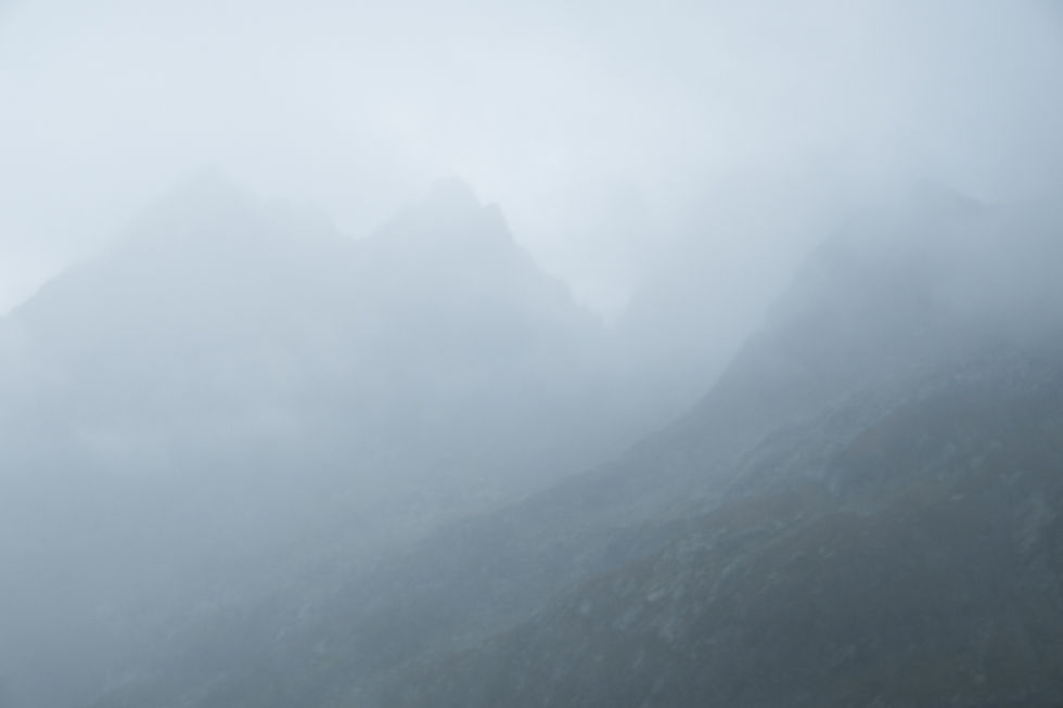
The hike in photos:
DAY 1 Le Buet to Refuge de la Pierre à Bérard // 6.41 km, 608 m

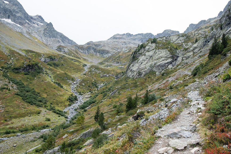

DAY 2 Refuge de la Pierre à Bérard to Refuge Moëde Anterne // 12.37 km, 934 m


DAY 3 Refuge Moëde Anterne to Lacs des Chéserys // 21.28 km, 1,435 m


DAY 4 Lacs des Chéserys to Le Buet // 7.33 km, 42 m


Postscript
A bit of a personal update to share. After six years of being adventure partners, Brett and I are no longer together. I won't go into the details of the breakup other than to say that I was completely blindsided by the whole thing and it's going to take me awhile to heal.
This trip to the French Alps was our last adventure together. Just typing that sentence makes me want to cry. I had a whole blog post drafted about our hike, but I can't bring myself to read back through it to edit it. To be completely honest, I spent most of the trip pretty miserable and anything I wrote before we officially broke up would probably have been a lie to make it seem like we had a good time. But I'm still proud of the photos I took and it was a beautiful hike, so I wanted to share them.
I started Coves to Cliffs just over five years ago and in that time, I've loved documenting the adventures that Brett and I have been on together – it was while hiking on the South West Coast Path together that the idea for the blog first developed. And although this blog has always been my initiative, Brett is so deeply intertwined within it that it makes it hard for me to even want to continue sharing my photography and stories. But I'm not going to let his actions stop me from doing something I love.
As Brett and I discovered together back in 2020, life is just like hiking on the South West Coast Path. Sometimes you’re on the highs of the cliffs, sometimes you’re in the darkness of the coves. Right now, I’m trying my best to stay afloat amongst the crashing waves, desperately trying to just reach the sandy shelter of the cove. I know it will probably take awhile, but I know I’ll be back up on the cliffs again one day, looking out over a bright future.
As always, thank you for being here. Onwards to new adventures.
Love,
Veronica


Hammer Boom Shaft provides the strength and reliability needed.